Geography: Outline Maps
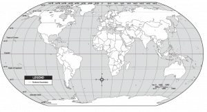 Geography: Outline Maps - Free printable maps (Grades 1-12) of : World (The Americas, Eastern Hemisphere, Northern Hemisphere, Southern Hemisphere, Climates, Continents, Countries, Pacific View, and Physical), Africa, Europe, South America, North America, United States, Historical (Colonial America, 1776, Lewis and Clark Routes, The 13 British Colonies, Trails to the West, The United States in 1860), Community Map, and Asia and the Pacific.
Integration of Knowledge and Ideas:
CCSS.ELA-Literacy.RI.3.7
Use information gained from illustrations (e.g., maps, photographs) and the words in a text to demonstrate understanding of the text (e.g., where, when, why, and how key events occur).
Integration of Knowledge and Ideas:
CCSS.ELA-Literacy.RH.6-8.7
Integrate visual information (e.g., in charts, graphs, photographs, videos, or maps) with other information in print and digital texts.